Feed URL: https://blogs.kent.ac.uk/digthewolds/2015/09/21/day-14-feature-2020-in-view/feed/?withoutcomments=1
Stop press! We have reached the bottom of 2020, which lies at around 2.3m below the field’s surface.
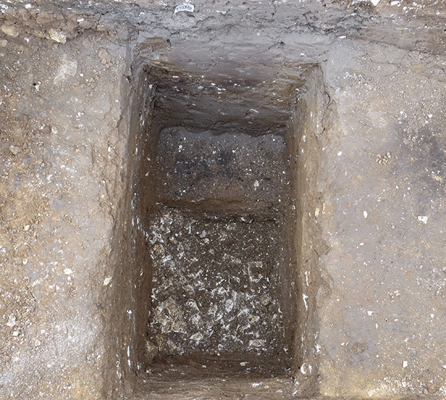
A view of the bottom of Feature 2020 at its centre point. The natural chalk is visible here and that it also continues to dip to the right (the eastern side of the feature).
We have now finished excavation work on Feature 2020. This massive pit was as large as Lloyd predicted it would be on the basis of the magnetometer survey. What was unknown was how deep it was. Well we now have some answer to that question. It is around 2.30m from the top of the current land surface to the top of the natural chalk at the bottom of our deepest excavation section at the approximate middle of the feature. Excavation shows the feature had a sloping western side which dips at a consistent angle, whilst the eastern edge is at a sharper angle, almost vertical. So whilst we have reached the bottom at the centre of the feature it is, here, still dipping quite sharply to the eastern side where it may be significantly deeper. Excavations at such depth need to continually consider health and safety. The fills of Feature 2020 have a strong clay component, especially those below the uppermost fills, and so are compact and make for firm sides, while the natural geology on the sides is solid chalk bedrock. We stepped in the excavations at both ends at an advised depth so that the soil fills were a natural brace. The lowest metre of our excavation at the centre point was a relatively narrow section and David somehow excavated this despite the challenge of the physics: his ‘wonder-spade’ perhaps had a secret extension to the handle and it evidently acted as a clay-magnet as he lifted out slices of the silty clay fill.
What is Feature 2020? When and why was it formed? One of our aims this year was certainly to see what this big ‘anomaly’ in our survey of the site represented. The strong readings on the magnetometer and its location in the geophysical plan suggested an area of burning and implied it was potentially part of the Roman site. Such large features are unusual on surveys, and aerial photos of sites on The Wolds. So we thought we needed to look at it as it might represent a kiln for making the tiles which are so prolific as fragments in the ploughsoil at the site or a pottery kiln using clay from the Waithe valley. Or was it to do with metalworking? Was it a well head? It proved not to be a kiln or oven. There was a quite striking deposit on the centre, halfway down of ash and burnt material including much carbonized bone and perhaps this was increasing the readings on the magnetometer. We will study this exceptional deposit from the samples collected; it seems to be the remains of an in situ fire. Elizabeth suggests it could be a ‘termination deposit’ marking the closure of use of the feature in ancient times. For sure the fills above it look like natural accumulations and filling in of settlement down of the lower fills.
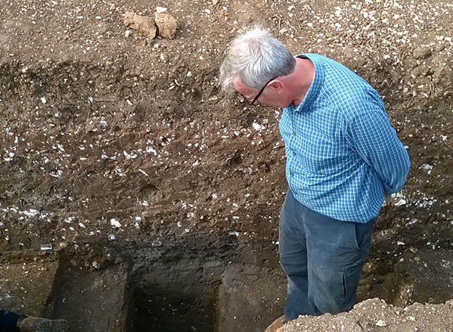
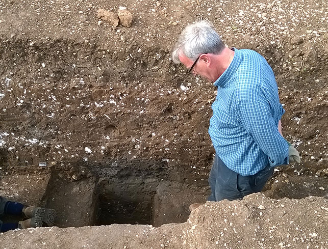
Graham contemplating how far off from reaching the bottom of feature 2020 we are, in our deepest excavated section.
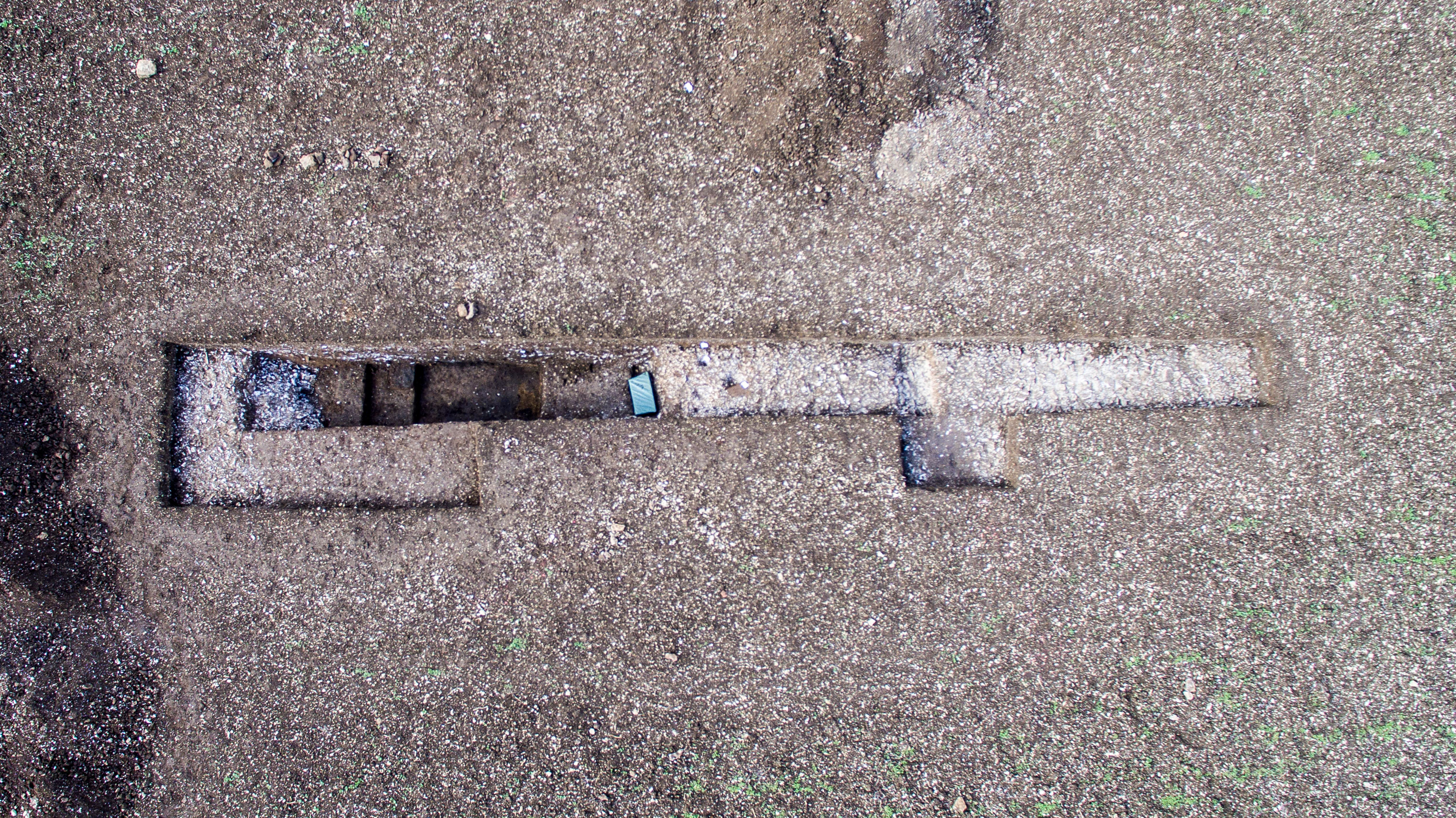
Aerial photo of Trench B earlier last week. Feature 2020 partly excavated can be seen as the dark soils surrounded by chalk; Ashwini’s ditch with oysters lies to the right. For scale, the trench is 14m in length. Photo courtesy of Mike.
The lowest fills of the feature produced Roman finds including a nail and small shards of pot. This indicates the feature began filling in the Roman period. So we have a date. It is possible that the lowest part of the feature is by its eastern side which we have not fully excavated and so there is an element of uncertainty remaining as to the full profile and date of the feature. As to its function, we may have better information once the finds have been studied and the soil samples analyzed. It seems the pit was created (or at least open and filling up) in the Roman period. It may be the top of a well, the main shaft of which was to the side of our excavations, or a water pit lined with clay, given that the lowest fills we found are mainly composed of clay which would have held water. Our preferred suggestion just now is that it was opened to dig out chalk to turn into lime to make the mortar used to build the Roman house. In fact we found a layer of sand and grit low down in the feature which (itself) must have been quarried out elsewhere and brought to the settlement, presumably for construction. Once the chalk had been extracted and the building/s completed it looks as though this massive feature was back-filled with surrounding soils. There are some Roman finds in these lower fills but the latter are, broadly, remarkable ‘clean’ of the sorts of debris normally found at Roman period settlements (and totally contrast, for instance, with the layers seen at our own nearby Trench C). So we think the pit must have been dug and intentionally back-filled around the start of the occupation of the site, before there was much debris, etc. around which is so much a signature of life and activity at sites of the Roman period.
We think we heard David say “if you can think of a better hole, you’re welcome to get in it”, to paraphrase the famous words of Bruce Bainsfather (the World War I cartoonist).